View Interactive Map
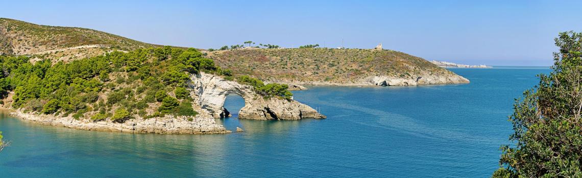
The Gargano is an Italian subregion which coincides with the mountainous promontory of the same name that extends into the northern part of Puglia and corresponds to the eastern part of the Province of Foggia. Known also as the "Spur of Italy", it is surrounded by the Adriatic Sea on all sides except on the west, where it borders with the Tavoliere delle Puglie plain.
Municipalities
This area includes fourteen municipalities: Cagnano Varano, Carpino, Ischitella, Mattinata, Monte Sant'Angelo, Peschici, Rignano Garganico, Rodi Garganico, San Giovanni Rotondo, San Marco in Lamis, San Nicandro Garganico, Tremiti (Islands), Vico del Gargano, and Vieste.
Natural heritage
This area represents the main tourist attraction of the Puglia Region and among the main ones in Italy, thanks to the variety and uniqueness of its places.
Its territory consists of 1,700 sq km along the Adriatic Coast, 10,426 sq km of Foresta Umbra, also called "Forest of the Mountain", and Bosco Quarto with an area of about 8 thousand hectares. Other geographical features are Mount Spigno (1008 m., in the municipality of Monte Sant'Angelo) and Mount D'Elio (264 m., a complex of hills in the municipality of San Nicandro Garganico); the S. Giovanni plain is overlooked by the highest peaks of the Gargano, including Mount Calvo (1056 m.) and Mount Nero (1011 m.).
The territory also includes Lake of Varano, with a surface area of about 60.5 km², carved out of the Gargano limestone, and located between the Mount D'Elio promontory and the point of Rodi Garganico point; its waters are shared by the municipalities of Cagnano Varano, Carpino and Ischitella.
Scattered chestnut woods, religion, folklore, crafts, history, local products, tradition and its 14 Municipalities make of the Gargano a rich and varied land.